Exploring South Iceland: Fog, Cliffs, Puffins, and Ice Caves
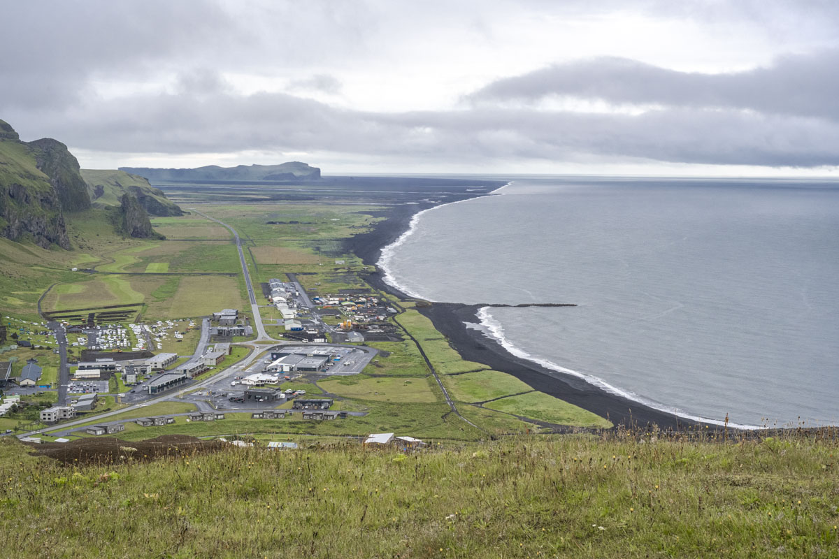
We landed in Iceland and drove straight from the airport to Vík. The route took us over Hellisheiði Pass through the thickest fog I’ve ever experienced, which made for a dramatic start. Vík is the southernmost village in Iceland, tucked between the Atlantic Ocean and steep volcanic cliffs. It’s small—just a few hundred residents—but it’s a popular base for exploring the surrounding coast, glaciers, and hiking trails.
Reynisfjall and Reynisfjara Beach
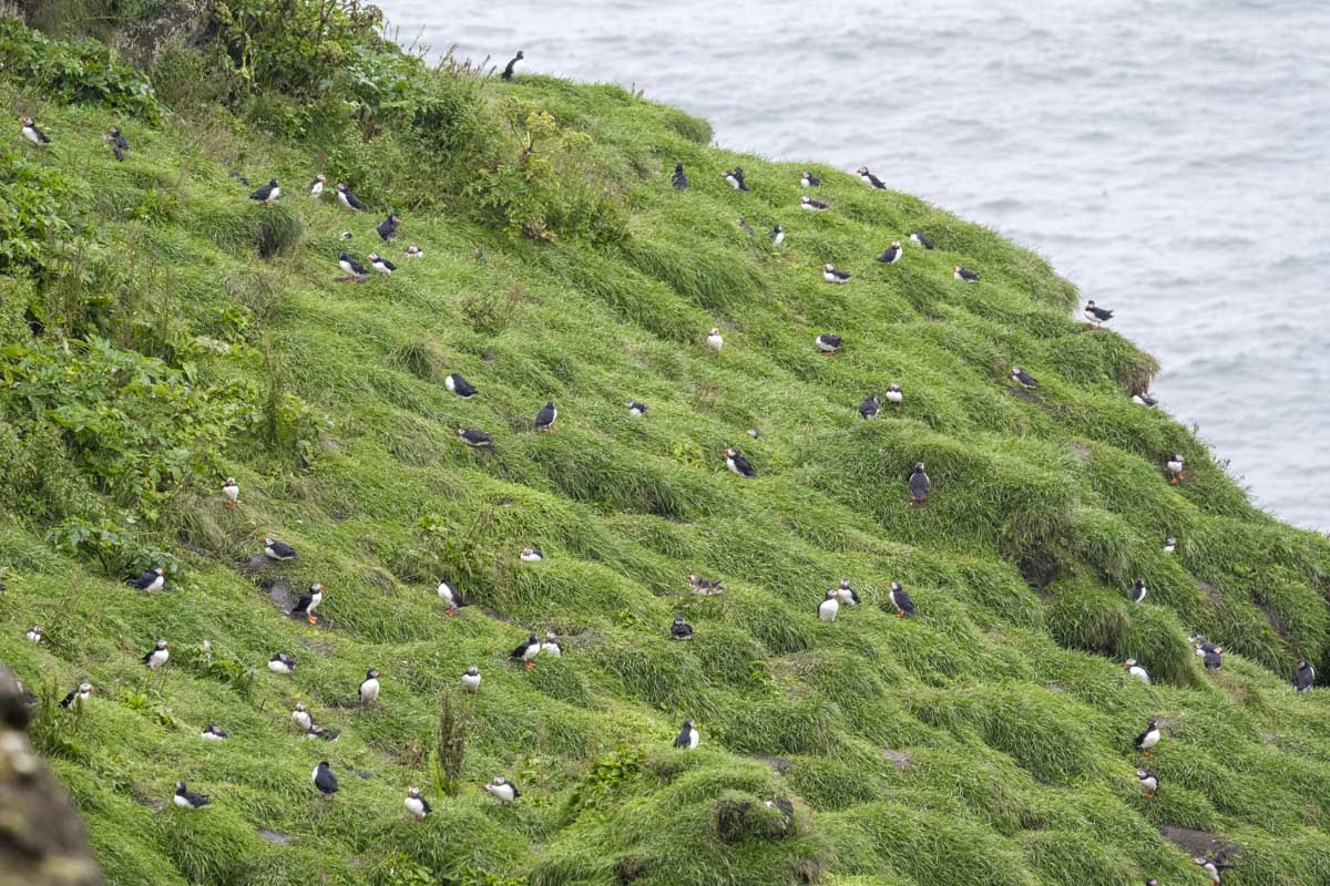
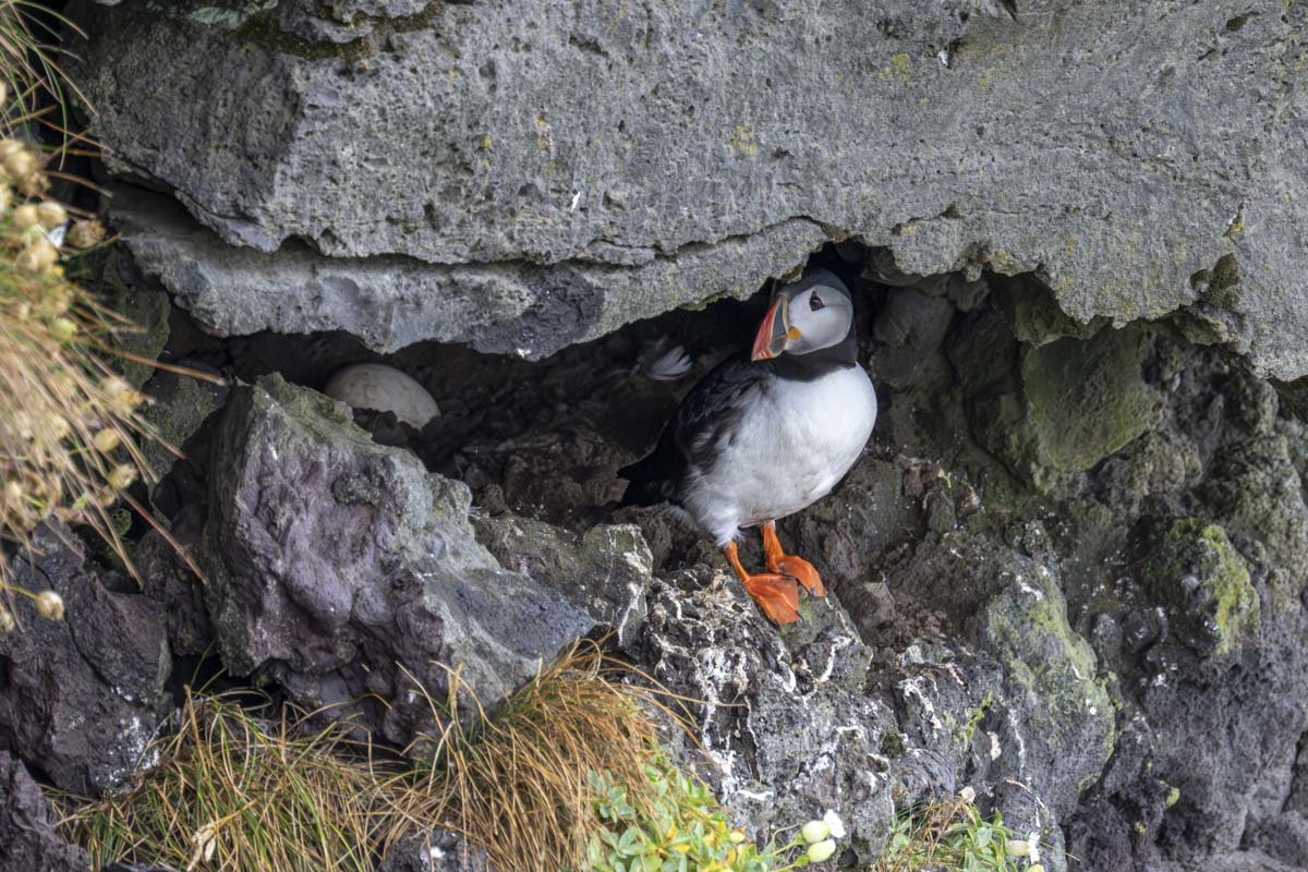
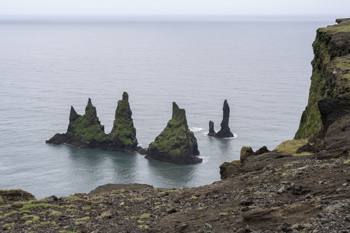
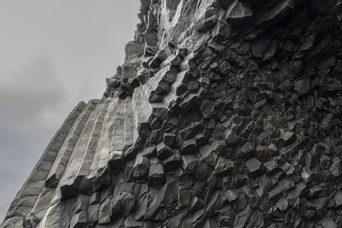
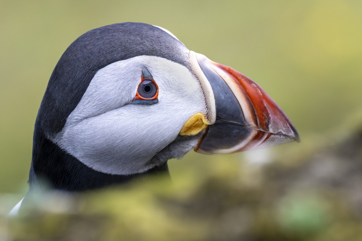
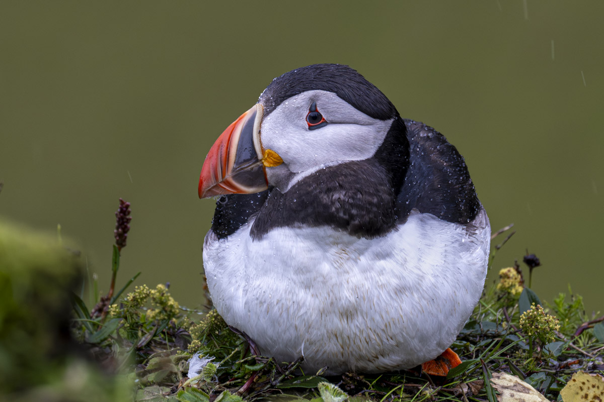
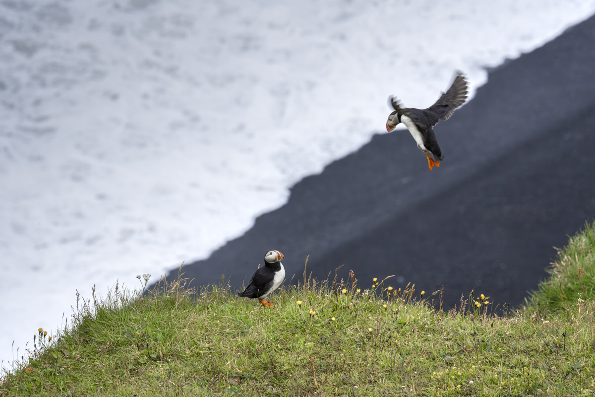
The next morning, we tackled a 4.2-mile hike on Reynisfjall, a tuff mountain made from volcanic ash and lava. The trail is a moderate loop or out-and-back with about 1,181 feet of elevation gain. At the top, the views are impressive: Vík lies to the east, Reynisfjara’s black sand beach stretches westward, and to the south, the Reynisdrangar sea stacks, the Dyrhólaey arch, and the waves of the Atlantic. But the highlight was the puffins! Hundreds of them nested on the cliffs and soared above the ocean, looking for their next meal. Afterward, we walked down to the black-sand beach and marveled at the black basalt columns, keeping our eyes out for the notorious sneaker waves.

Dyrhólaey Lighthouse and Nature Reserve
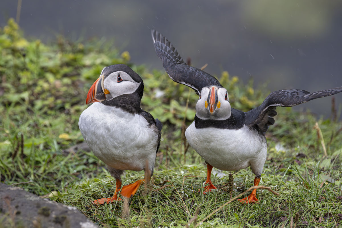
Later that day, we visited the Dyrhólaey nature reserve and lighthouse. The lighthouse was built in 1927 and sits on a 120-meter cliff, giving it one of the highest focal points in Iceland. Dyrhólaey means “door hill island,” named after the sea arch that boats can pass through. Dyrhólaey used to be an island, but volcanic deposits connected it to the mainland. It was Iceland’s southernmost point until the Katla eruption in 1918. We were delighted by even more puffins! The cliffs are a nesting site for Atlantic puffins from May to August, and we also spotted Eider ducks and Arctic terns.
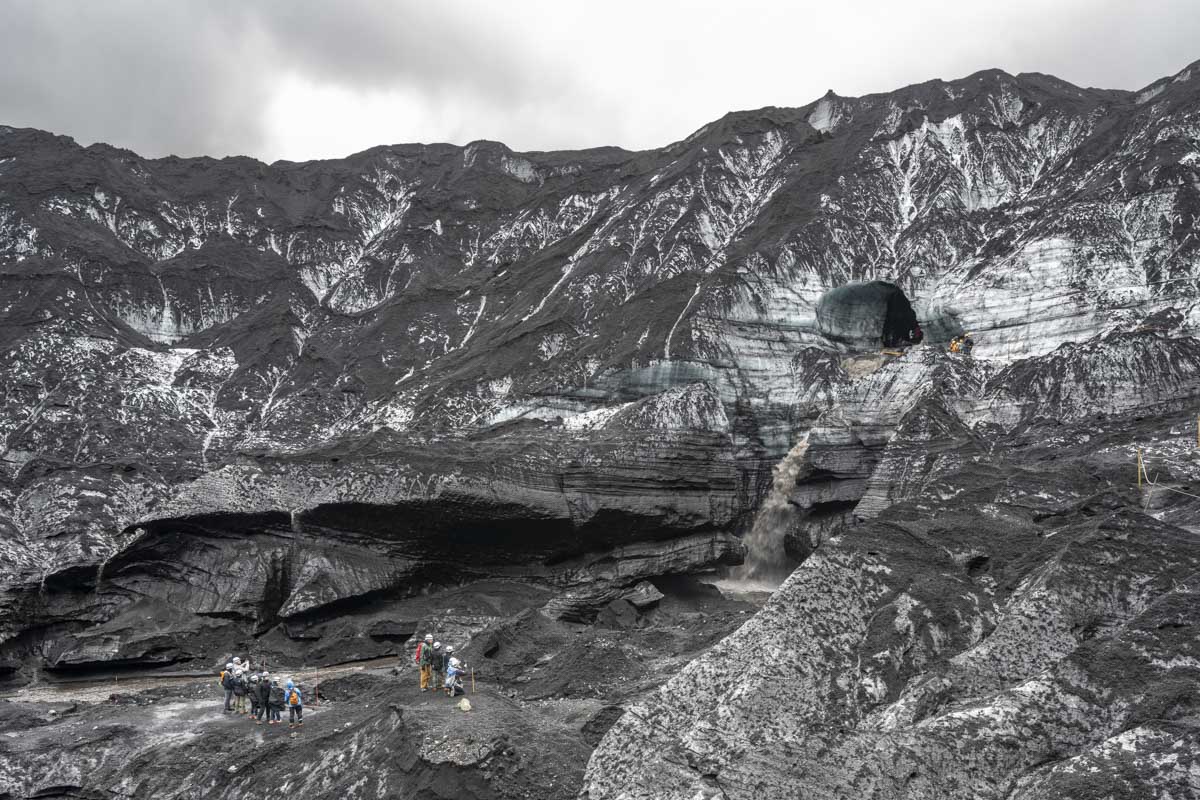
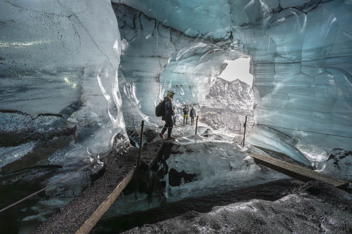
Katla Ice Cave Tour
The next day, we joined a super-jeep tour to the Katla Ice Cave. What people call “Katla Glacier” is actually the Kötlujökull outlet glacier, which flows from the Mýrdalsjökull ice cap. Beneath it lies Katla, one of Iceland’s most dangerous volcanoes. The Katla Ice Cave is accessible year-round thanks to its stable structure. The ice inside ranges from clear to deep black, streaked with volcanic ash. We hiked up with crampons and helmets, crossing fast-moving streams and lahar fields from past eruptions. Inside, we saw deep layers of perfectly clear ice and even got a shot of vodka chilled with an 8,000-year-old ice chip.
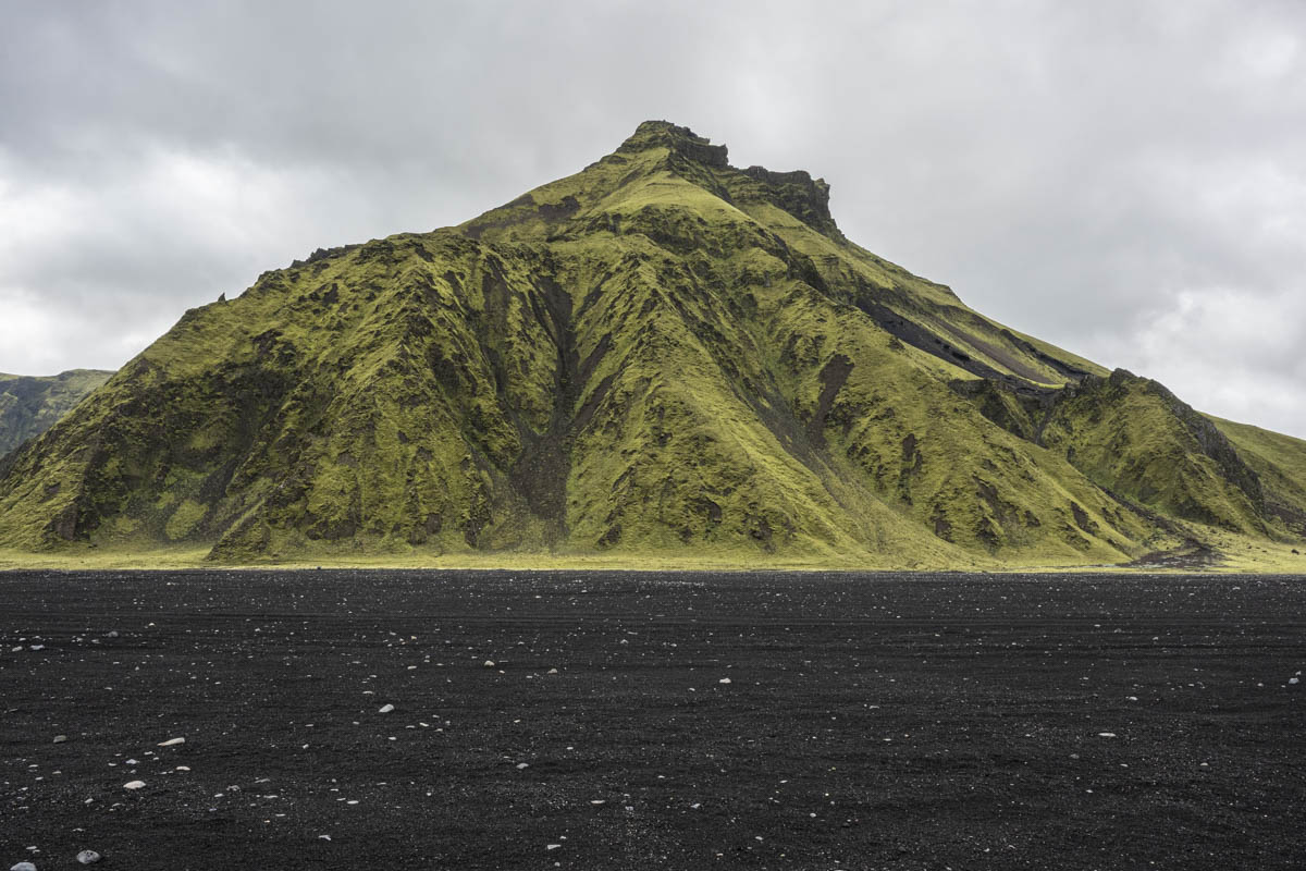
Just east of Vík rises Hjörleifshöfði, another tuff mountain covered in bright green moss and surrounded by the black sands of the Mýrdalssandur outwash plain. A few scenes of Rogue One: A Star Wars Story used Hjörleifshöfði as a backdrop!
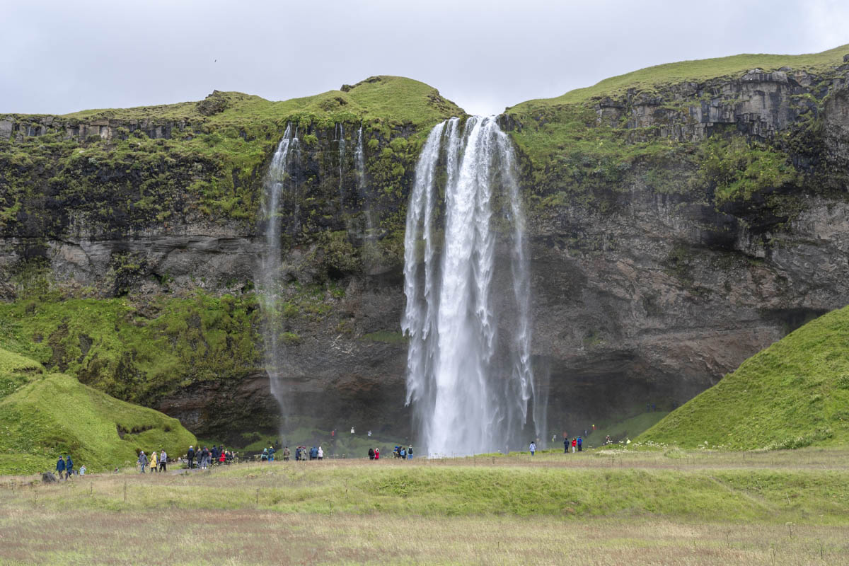
Seljalandsfoss Waterfall and Reykjavik
On our drive back to Reykjavík, we made a quick stop at Seljalandsfoss. It’s one of Iceland’s most famous waterfalls, dropping about 60 meters from the cliffs of the former coastline. There’s a path that lets you walk behind the waterfall—just be ready to get wet. We closed out this amazing trip with a few days in the capital city. We strolled through Laugavegur Street sampling delicious pastries and admiring the street art.

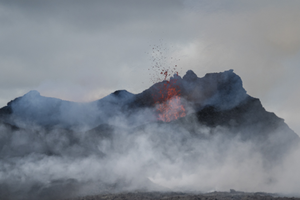
Katla Volcano
We took a super-jeep across the rough lava fields to see the Katla Volcano. We spent about an hour watching and photographing the volcano, though between the distance, heat distortion, and volcanic smoke, it was hard to see much detail.