Faroe Islands: Sun in the Northern Isles
After two days of exploring the Faroes by sea, it was time to drive north toward the Norðoyar, six rugged islands clustered in the northeast of the archipelago. While all the Faroes are remote, the Norðoyar are considered by locals to be the most remote: rugged, wild, and known for independent spirit. You can drive to four of these islands through an impressive network of causeways and subsea tunnels, and we planned to visit three on today’s adventure.
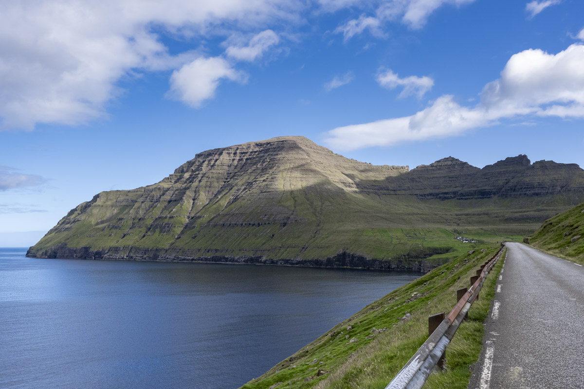
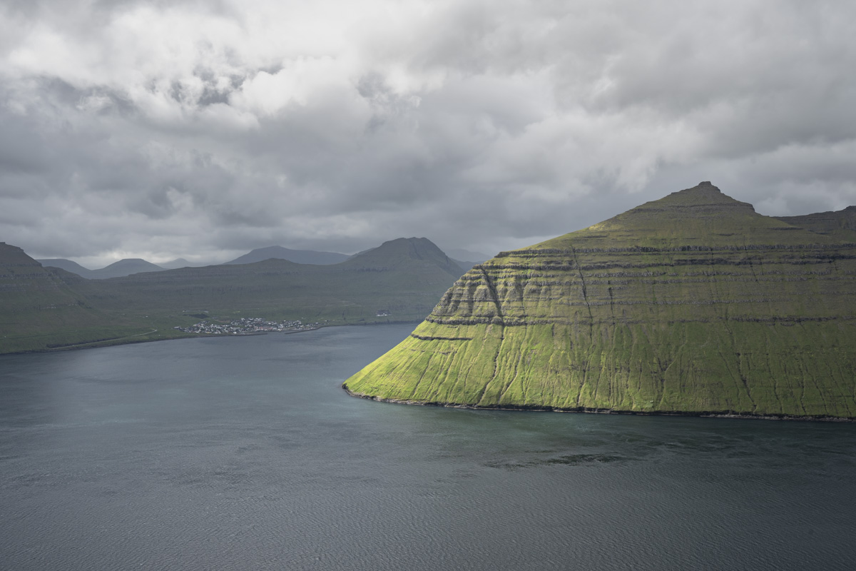
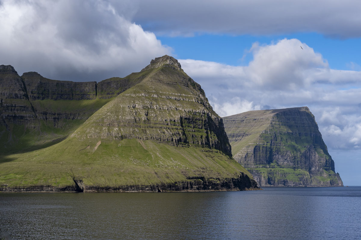
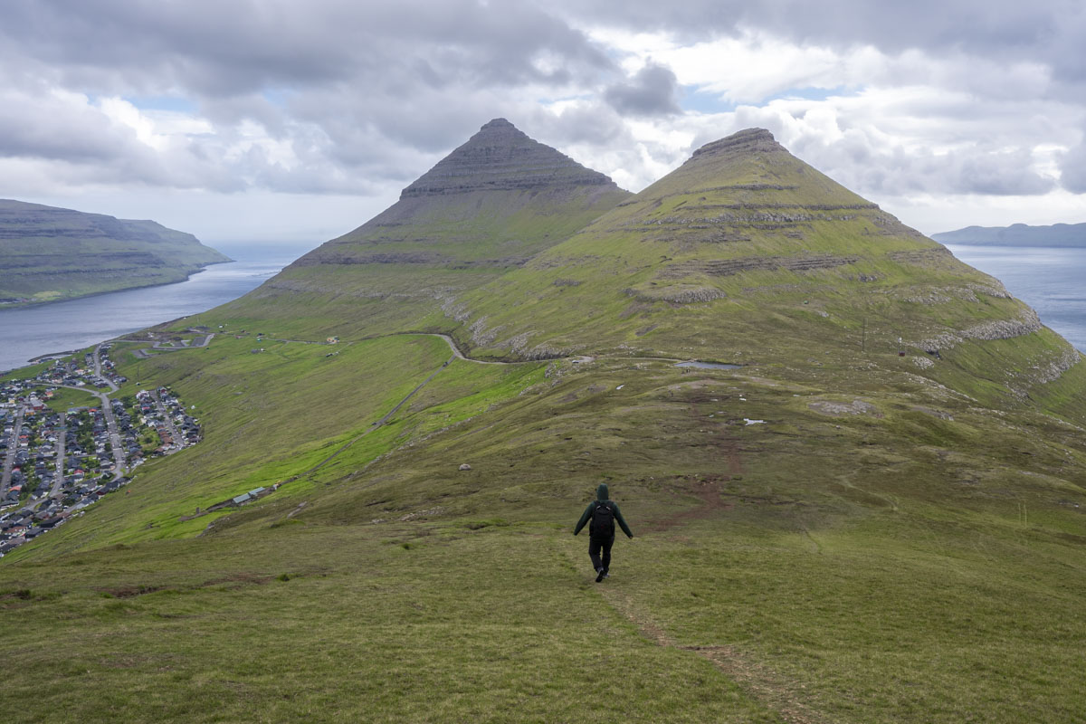
We drove through the isle of Borðoy, past glacially carved fjords and basaltic strata, to Viðoy island and continued until we reached the storybook village of Viðareiði, which sits on a narrow isthmus between two mountains: Villingadalsfjall to the north (844 m), the highest peak in the North Islands, and Malinsfjall to the south (751 m). From here, you get expansive views of the islands of Borðoy, Kunoy, and Fugloy. Cape Enniberg is nearby too—Europe’s second-highest sea cliff and the tallest vertical promontory in the world.
Many of the hikes in the Faroes are on private property and require a fee. We paid 200 DKK for the Villingadalsfjall hike and started up the slope. The climb starts at the trailhead, and we ascended over 1,000 feet in the first mile. It was our first sunny day of the trip, and the light was magical on the horizon. But the trail became slippery with loose basalt. We’d read that the trail becomes a scramble, so we turned back before that point and descended to the Viðareiði, satisfied with the amazing views.
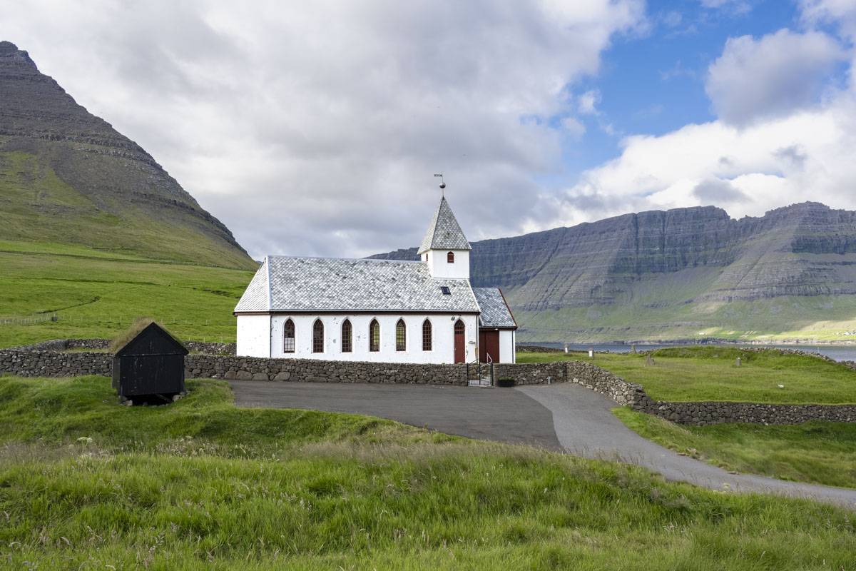
Viðareiði has a storied history. It was first mentioned in the Hundabrævið (Dog Letter) between 1350 and 1400 and served as the capital of the Northern Islands until 1934. The church here was built in 1892, but the site’s history goes much further back. A storm in the 1600s destroyed the earlier church and swept coffins into the sea. In 1847, locals rescued sailors from the wrecked brig Marwood, and the British government later gifted silver to the church in thanks.
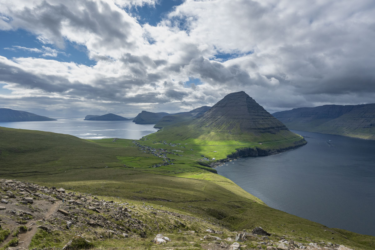
After our hike, we drove back to Borðoy and stopped for lunch at Café Frída in Klaksvík. The town is the second largest in the Faroes, tucked between fjords and framed by mountains like Kunoyarnakki, a pyramid-shaped peak that dominates the skyline. Later, we hiked the Klakkur viewpoint trail. Hikers start on Ástarbreytin (“Love Path”), a gravel road locals favor, then head to the Hálsur saddle and across grassy, boggy fields to the top.
After two short but steep hikes, we were ready for some relaxing time in Tórshavn. The Norðoyar had been a lovely place to spend the sunniest day of the vacation.