Faroe Islands: Vágar and Vestmanna
On Day 5, we explored Vágar Island.
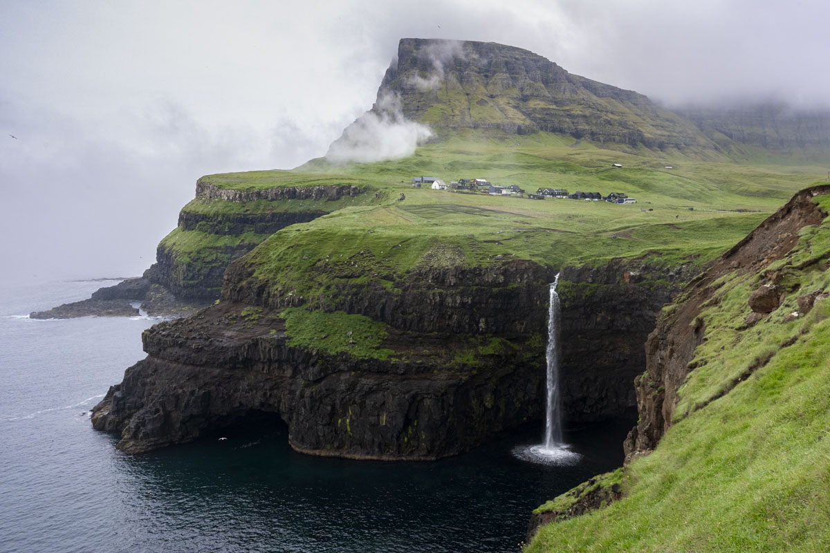
We got an early start and drove to Gásadalur, a village on the western edge of the island. Its name translates to “Goose Valley” in Faroese. Flanked by two towering mountains—Arnafjall, the highest peak on Vágar, and Eysturtindur, the “peak to the east”—the valley is also home to Múlafossur, a stunning waterfall that drops 98 feet into the North Atlantic.
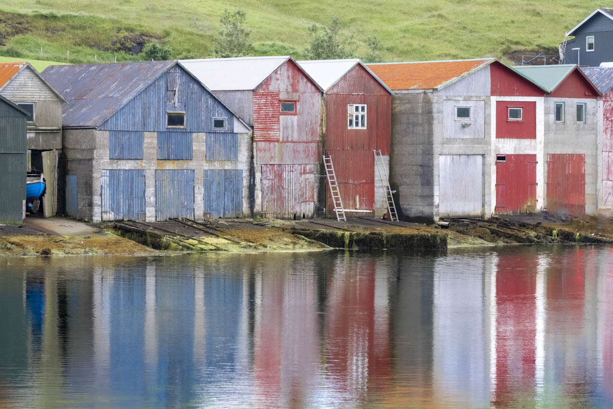
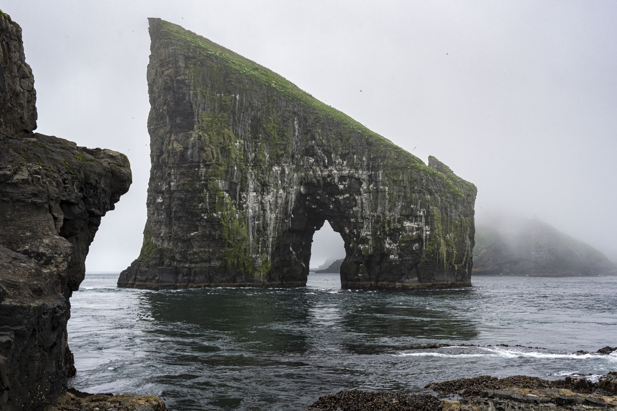
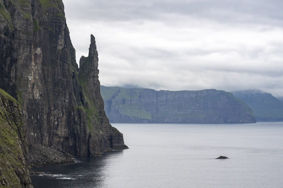
We returned through the intimidating Gásadalstunnilin, the one-lane tunnel that connects this magical valley to the rest of Vágar. If you see headlights approaching through the darkness, you hope there’s a convenient Møtipláss, or pullout, to squeeze into so the other car can pass. Our next stop was Sørvágur, a small town near the only airport, originally constructed by the British Royal Engineers during WWII. From the harbor, we boarded a RIB (Rigid Inflatable Boat) for a short ride to see Drangarnir and Tindhólmur—iconic sea stacks and islets off the western coast.
The tour lets you out on a rocky shoreline opposite Drangarnir, a peninsula that juts from the mainland. It’s privately owned, so visitors must stay on the headland. We climbed the steep slope for views of the sea arch, which appears in How to Train Your Dragon (2025). Tindhólmur, a dramatic islet shaped like half a mountain, was obscured by fog, but our guide described its five sharp peaks and its role as a nesting site for seabirds.
We ate lunch at Fiskastykkið Café in Sandavágur. The name refers to the stone-paved fish drying area where salted cod (bacalao) was once laid out to cure in the sea breeze—a nod to the village’s fishing heritage. After lunch, we hiked to Trøllkonufingur, or Witch’s Finger, a sea stack steeped in folklore. Legend says a witch tried to throw the Faroe Islands to Iceland, but as she reached the sea near Vágar, the sun rose and turned her to stone. She fell into the ocean, face down—her finger became Trøllkonufingur, and the back of her head became the island of Koltur.
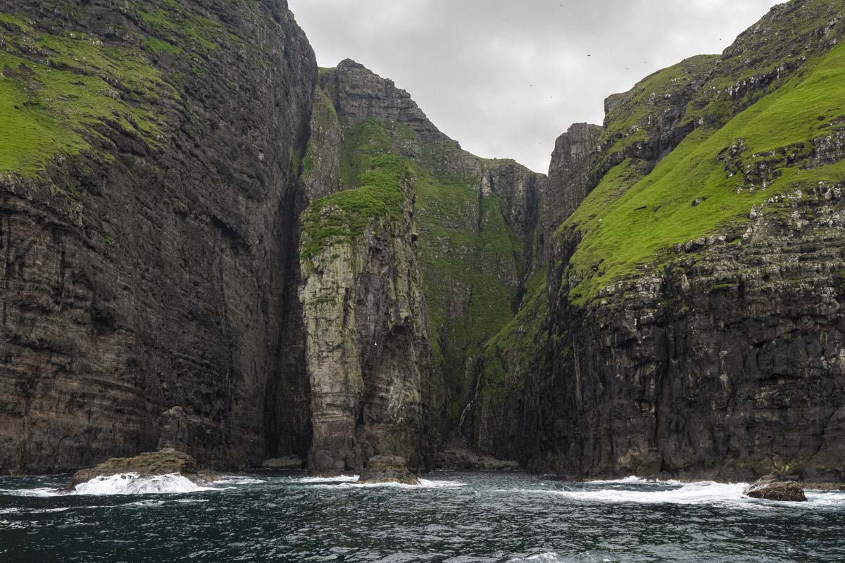
Day 6 brought another boat tour—this time to the Bird Cliffs of Vestmanna.
We found seats on the boat’s upper deck, which was open to the sea air. The waves were tumultuous, tossing the boat so that staying seated was a challenge, and standing required a firm grip. The cliffs are startlingly beautiful and otherworldly: rising 2,300 feet from the sea, they stretch across 5 kilometers of coastline. From sea level, the basalt walls, sea stacks, and dark grottos form a strange, unfamiliar geometry. Despite the rough conditions, our captain navigated the narrow passages with ease. The skies were alive with seabirds—puffins, razorbills, guillemots, and fulmars all call this wild place home.
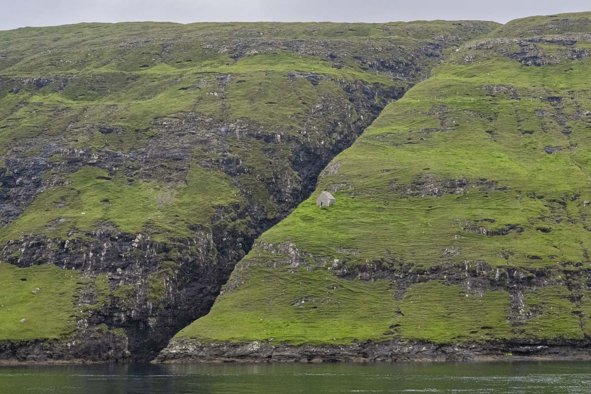
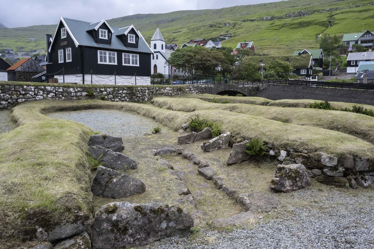
On the way back to Tórshavn, we stopped in Kvívík, one of the oldest settlements in the Faroes. Viking-era excavations here date back to the 10th century. Archaeologists uncovered two longhouses—one for humans, one for livestock—right by the seaside. The floors were layered with stone, ash, soot, clay, and sand, and the turf roofs were held down with juniper cords.
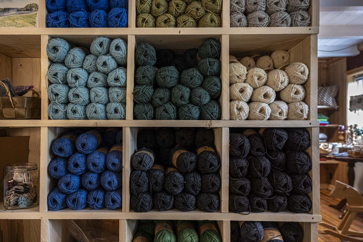
We also stopped in at the lovely Kvívíknit store to buy local yarn and mittens woven by a collective of islanders.