Faroe Islands: A Cairn-Marked Path
In northern Streymoy, two remote villages—Saksun and Tjørnuvík—share a longstanding connection. They’re linked by a mountainous five-mile trail marked with stone cairns, where placid sheep graze beneath jagged basalt spires. Historically, this was more than a hiking route – it was the connection for trade, community, and religious services.
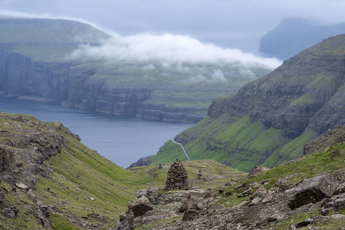
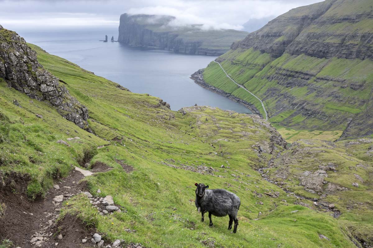
If you begin the hike from Saksun, you’re greeted with sweeping views of the famed Saksun Church and the Pollurin, a circular tidal lagoon surrounded by cliffs. Starting from Tjørnuvík, the legendary sea stacks Risin og Kellingin—the Giant and the Witch—rise from the surf, near the entrance to the harbor. Between these two villages lies Frammi í Dal, a rugged highland valley where the river Gellingará flows toward Tjørnuvík. Often shrouded in mist, it’s easy to lose the path even with the cairns to mark the way.
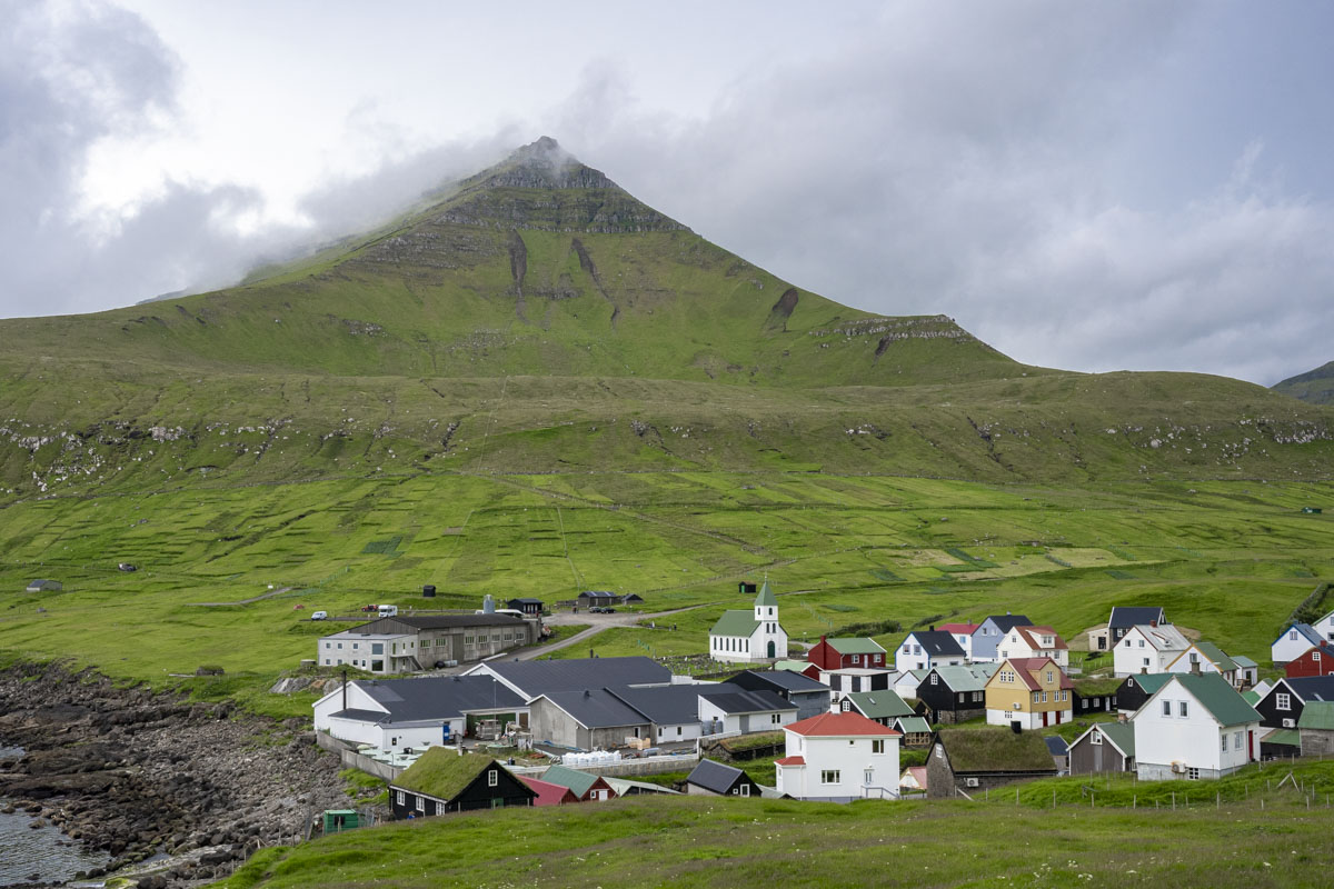
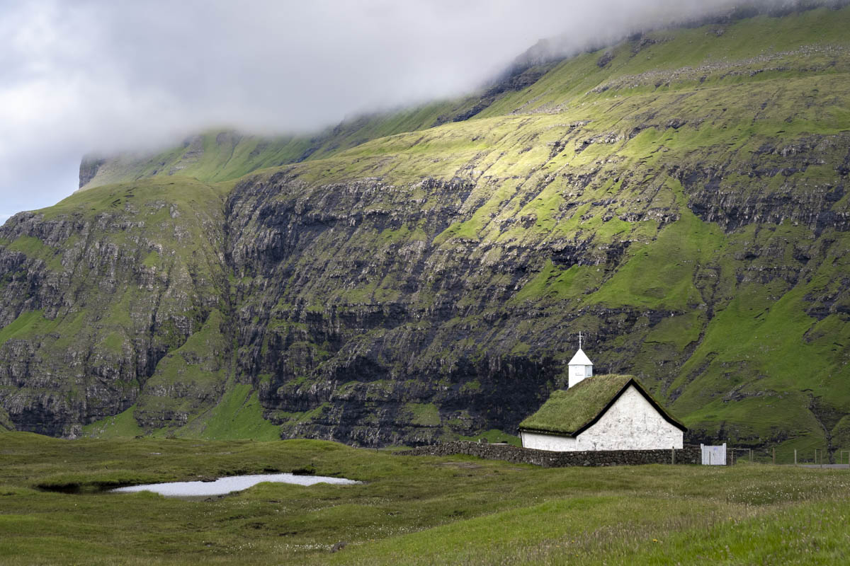
We began our day in Saksun, a village first recorded in the 1400s, though it’s likely older than that. Nestled in a natural amphitheater on the northwest coast, Saksun is encircled by towering basalt ridges. The River Dalsá cuts through the village toward the sea, where volcanic black sand marks the entrance to the lagoon. Turf-roofed houses dot the green hillsides, and the churchs stands watch from a cliff above the harbor. Originally built in Tjørnuvík, the church was disassembled and carried along the cairn-marked path to Saksun in 1858—a feat of endurance that makes me wonder how the villagers in Tjørnuvík felt about the loss of their house of worship.
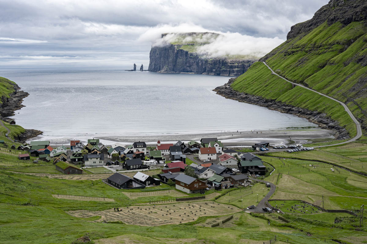
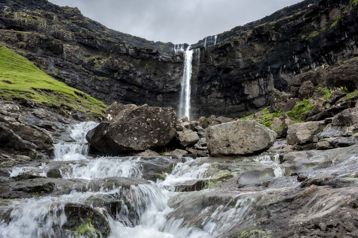
From Saksun, we drove toward Tjørnuvík, a journey of about 40 minutes through winding roads and dramatic terrain. We paused at Fossá Waterfall, the tallest in the Faroe Islands, where whitewater tumbles 140 meters down a dark basalt cliff. The final stretch into Tjørnuvík is a single-lane road, traffic directed by a stoplight, with breathtaking views of the sea stacks Risin og Kellingin rising beyond the harbor.
Tjørnuvík itself is a picturesque village nestled between steep cliffs and facing the Sundini Strait. We opted not to do the full ten-mile round-trip hike—the weather was dodgy—but we set out from the Tjørnuvík side, beginning at the southern edge of the village near the black sand beach. The trail climbed steeply at first, past villagers haying in narrow fields tucked behind the turf-shod homes. As we passed sheep grazing on precarious ledges, we hoped for a break in the weather. The cairns led us into the highlands, where mist awaited—obscuring the path. We turned back, content with the dramatic views of the sea stacks on our descent.
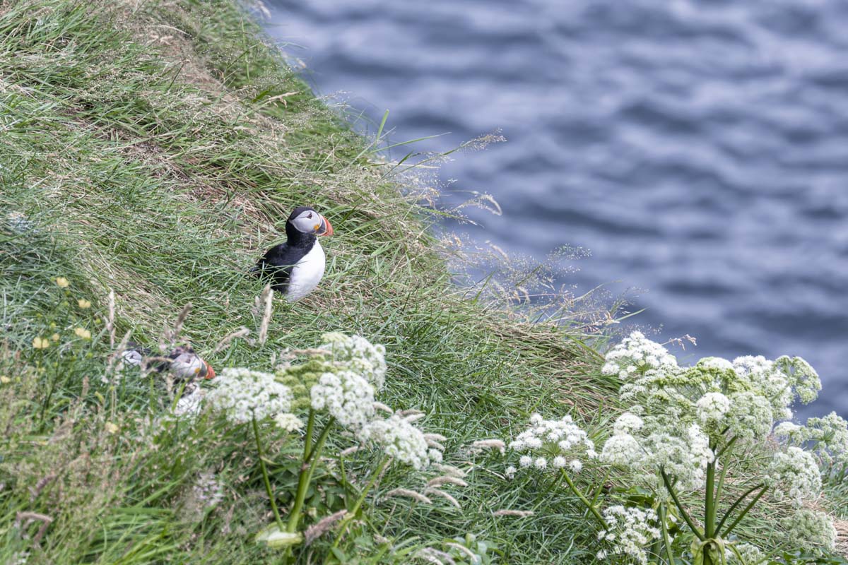
Our day continued across the rugged beauty of northern Eysturoy, where we passed Slættaratindur, the highest peak in the Faroe Islands. Its name translates to “flat summit,” though today its apex was lost in cloud. Our final stop was Gjógv, a village named for the 200-meter-long gorge that slices through its center. Puffins nested on the cliffs along the gorge, and we lingered, watching these marvelous birds fish in the wild waves below.